Blog
Testing a Gravel bike through the Caroig massif
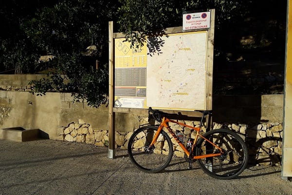
One spring afternoon I was in the mood to do a route with the new Gravel bike that I’ve done countless times with the mountain bike, what we’ve always called in Quesa “the tour de Ludey”. Anti-clockwise this time, to avoid the hard ramps on the climb to the Planil. A route on which I will venture a little into the Caroche (Caroig) massif, and which will allow me to glimpse the immensity of this territory.
I leave the Hotel La Rocha and go through the CV-580 district to Bicorp. I start the port, but at the first bend, at km 4, I turn left onto a concrete track that after less than one km changes to dirt and follows the river Escalona.
2 km further on, I turn left, again along a concrete track. Here I begin the long 6 km climb, known to Quesa cyclists as “the slope of Ludey”. At first, it’s gentle, between 2% and 4%. Little by little, I move away from the river and almost cease to hear the sound of the water. When I cross the River Ludey, which comes from the left, the second part begins with a steeper slope, which is now between 6% and 8%, and which changes from north to southeast. The surface is very good - asphalt but of the kind made using irrigation and gravel, which is much more pleasant to ride over than the tarmacadam used on roads. As I gain altitude the views improve. I must bear in mind to pace myself since it’s a long ascent. At km 10 I come to a flat stretch, which my legs appreciate, and here I begin the final part, which keeps the slope changing to a north-western slope, but a little further on it becomes dirt. The landscape is spectacular, I can’t stop looking to the Caroche peak to the right, while I try to maintain the gentle pace, I’ve set myself but which is already killing me.
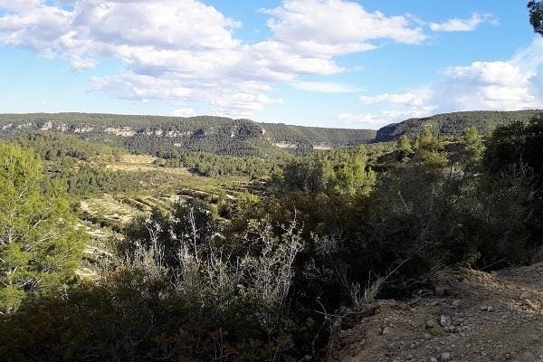
At km 11.9 I reach the top; I stop to look around and have a drink of water. I continue along the plain for only 1 km until I reach the vantage point
in which I can make out the Las Arenas ravine, the River Ludey and Caroche to the west. I stop again: the landscape makes it unavoidable.
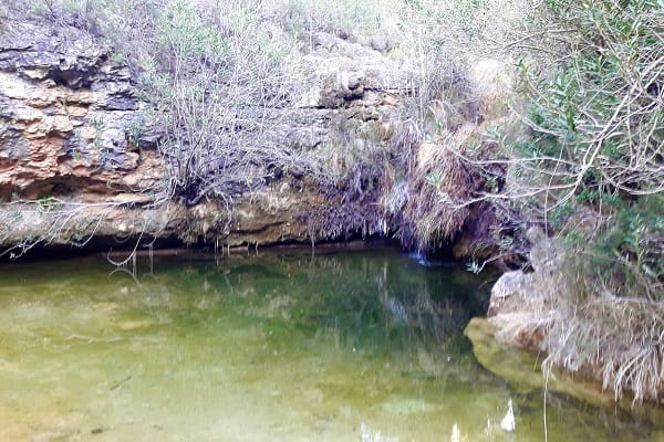
Sadly, after 1 km the descent stops and turns into a steep slope, which luckily evens out a bit over the rest of the climb to El Planil. Just where the slope ends there's a water tank for firefighting that's fed by the spring of Las Tortugas. It's difficult to find the spring because of the way the terrain changed after the tank was built, but if I had been hot I could have had a dip in Las Tortugas pool.
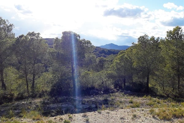
I continue climbing, passing the Cubillas pool, and at km 16 I reach El Planil. Except for a small climb, the place lives up to its name. I go onto the drops and enjoy the flat track, which at this point really ought to be called a forest “race track”. In some places I can see the Mediterranean sea through the pines.
At km 18.5, on the way down, I'm still enjoying the good track surface, allowing me to lift my gaze and try to guess which villages I can spot down below. At km 20 I reach the tarmac road and I have to tackle steep sections with tight bends and gravel, so I need to stay alert.
The steep descent levels out after the junction leading to the Los Charcos recreational area. I continue my gradual descent round the bends in the road until I cross the Grande river after a sharp downhill section. I start the 1.5 km climb at a lively pace because I know it's the last one. As I reach the top I can see Quesa, I cruise along the flat for a while to ease out the muscles and when I get to the descent I can reach the town without a single pedal stroke.
Note: Keep a bit of energy for the steep section up to the hotel, that's the price you pay for good views.